By the Koh-Lanta-Island.com editorial team · · How we work
Short answer
Koh Lanta is a group of islands in Krabi Province, southern Thailand, on the Andaman Sea. The main island, Koh Lanta Yai, is about 81 square kilometres and has no airport. Most visitors fly to Krabi, then take a road transfer and car ferry. The dry season runs roughly November to April.
This page collects the basic facts about Koh Lanta in one place. Each value is either from a cited source or from other pages on this site, and where a figure is uncertain we give a cautious range or send you to the official source.
Facts were last checked on 2026-09-20. Schedules, fees and closure dates are set by operators and authorities, so confirm anything time-sensitive before you travel.
Summarize this page with AI
What are the basic facts about Koh Lanta?
| Item | Fact |
|---|---|
| Location | Krabi Province, southern Thailand, on the Andaman Sea (west coast of the Thai peninsula) |
| District | Ko Lanta District, Krabi Province |
| Main island | Koh Lanta Yai, where the beaches and most hotels are. It is joined by a bridge to the smaller, flatter Koh Lanta Noi to the north. |
| Size of Koh Lanta Yai | About 81 square kilometres, roughly 25 to 30 km long and about 6 km wide (sources give slightly different lengths) |
| Population of Koh Lanta Yai | 10,830 in 2012 (the figure reported on Wikipedia). Treat it as an older estimate. |
| Nearest airport | Krabi International Airport (KBV). Koh Lanta has no airport. |
| Mainland link | Road transfer and a car ferry to Koh Lanta Noi, then a bridge to Koh Lanta Yai. A mainland bridge has been proposed but is not open. |
| Currency | Thai baht (THB). Cash is still the most reliable way to pay outside resorts. |
| Time zone | UTC+7 (Indochina Time), no daylight saving |
| Language | Thai. English is widely spoken in tourist areas. |
| Main beaches, north to south | Klong Dao, Long Beach (Phra Ae), Klong Khong, Klong Nin, Kantiang Bay, Bamboo Bay |
| National park | Mu Ko Lanta National Park, at the southern tip and on nearby islands. Entrance is 200 THB for foreign adults. |
| Historic centre | Koh Lanta Old Town, a stilt-house village on the east coast |
| Local culture | Home to Chao Leh (sea peoples), including Urak Lawoi and Moken communities |
Sources: Wikipedia and Wikivoyage for island size, population and general geography; thainationalparks.com for the park fee. Last checked 2026-09-20.
How do you get to Koh Lanta, in numbers?
For the full detail, see getting to Koh Lanta, Krabi Airport to Koh Lanta transfer options and Phuket to Koh Lanta. If you are wondering why there is no airport, read Koh Lanta airport: why there isn't one.
| Route | How it works | Indicative time |
|---|---|---|
| Krabi Airport to Koh Lanta | Road transfer, car ferry to Koh Lanta Noi, then the bridge to Koh Lanta Yai | About 1.5 to 2.5 hours door to door, depending on ferry queues and your beach |
| Krabi Town to Koh Lanta | About 70 km by road with a car ferry crossing (Wikivoyage) | Varies with traffic and ferry wait |
| Phuket to Koh Lanta | Long road transfer plus the same ferry, or a seasonal boat | Plan on a long travel day, not a couple of hours |
| Koh Lanta to Koh Lipe | Seasonal boats in the drier months (Wikivoyage reports around 3 hours) | Check current operators before planning |
| Koh Lanta to Koh Phi Phi | Seasonal passenger boats | Confirm with an operator, weather can cancel crossings |
Times are indicative and vary. Confirm with your transfer or boat operator close to your date.
Looking for things to book?
Below you will find a few tours we checked, and you can browse every Koh Lanta activity on GetYourGuide. Links are sponsored.
When is the season on Koh Lanta?
Weather varies from year to year, so treat these as tendencies rather than forecasts. For more detail, see best time to visit Koh Lanta, weather by month and the Koh Rok and Koh Ha seasonal closure. For numerical climate data, use the Thai Meteorological Department.
| Months | Season | What to expect | Koh Rok and Koh Ha |
|---|---|---|---|
| December to February | Peak dry season | Driest and busiest weeks, highest room rates, calm seas | Open |
| November, March | Dry season | Reliable weather, slightly better value than peak | Open |
| April | Late dry, hot | Hottest and most humid part of the year. First showers possible late in the month. | Open |
| 1 to 15 May | Transition | Weather can go either way | Open |
| 16 May to 14 October | Rainy season | Mixed sun and heavy showers, rougher seas, lower prices, some smaller guesthouses closed | Closed to visitors |
| 15 to 31 October | Transition | Rain often eases toward the end of the month | Reopened |
Koh Rok and Koh Ha closure: 16 May to 14 October, part of the national park's seasonal marine protection. Confirm annual dates with the park.
What are the key places on Koh Lanta?
| Place | What it is | Guide |
|---|---|---|
| Saladan | Ferry-pier town at the northern tip, with shops, banks and a night market | Old Town and Saladan |
| Koh Lanta Old Town | Historic stilt-house village on the east coast with seafood restaurants | Old Town guide |
| Klong Dao | Calm, shallow beach closest to Saladan pier | Klong Dao Beach |
| Long Beach (Phra Ae) | The longest and busiest beach, with the widest choice of restaurants and bars | Long Beach |
| Klong Khong | Smaller, laid-back, budget-leaning beach with beach bars | Klong Khong Beach |
| Klong Nin | Wide sandy beach with a growing boutique scene | Klong Nin Beach |
| Kantiang Bay | Sheltered bay with most higher-end resorts | Kantiang Bay |
| Bamboo Bay | Quiet southern bay away from the main strip | Bamboo Bay |
| Mu Ko Lanta National Park | Laem Tanod headland, lighthouse and trails at the southern tip | National park guide |
| Tung Yee Peng mangroves | Mangrove forest used for kayaking tours | Mangrove forest |
| Koh Rok, Koh Ha, Koh Kradan | Snorkelling and day-trip islands (Koh Rok and Koh Ha closed 16 May to 14 October) | Day-trip islands |
What should I check before I go?
Some details are set by governments or operators and change. Verify these with the official source before you travel.
- Entry rules and visas: check the Thai Ministry of Foreign Affairs requirements (linked in the sources below) for your nationality. This page does not give visa advice.
- National park fee: 200 THB for foreign adults according to thainationalparks.com. Fees are revised periodically. See the park fee and hours.
- Ferry and transfer details: confirm with your operator, see the car ferry guide.
- Weather and sea conditions: use the Thai Meteorological Department and local flags.
- Safety and health: read is Koh Lanta safe for tourists and your government's travel advice.
Frequently asked questions
Koh Lanta is in Krabi Province, southern Thailand, on the Andaman Sea coast. It lies south of Krabi town and is reached by road transfer, a car ferry and a bridge.
The main island, Koh Lanta Yai, is about 81 square kilometres, roughly 25 to 30 km long and about 6 km wide. The wider district includes several other islands.
No. The nearest airport is Krabi International Airport (KBV). From there it is roughly 1.5 to 2.5 hours by road transfer and car ferry, depending on queues and your beach.
The Thai baht (THB). Cash is the most reliable payment method outside larger hotels and restaurants. See [paying on the island](/koh-lanta-currency-and-paying-on-the-island).
They are closed to visitors from 16 May to 14 October each year as part of the national park's seasonal marine protection. Check with your tour operator for the current year.
It is 200 THB for foreign adult visitors according to thainationalparks.com. Fees for children and Thai nationals differ and are revised periodically, so confirm at the gate.
Sources and further reading
Tours that fit this plan
See all tours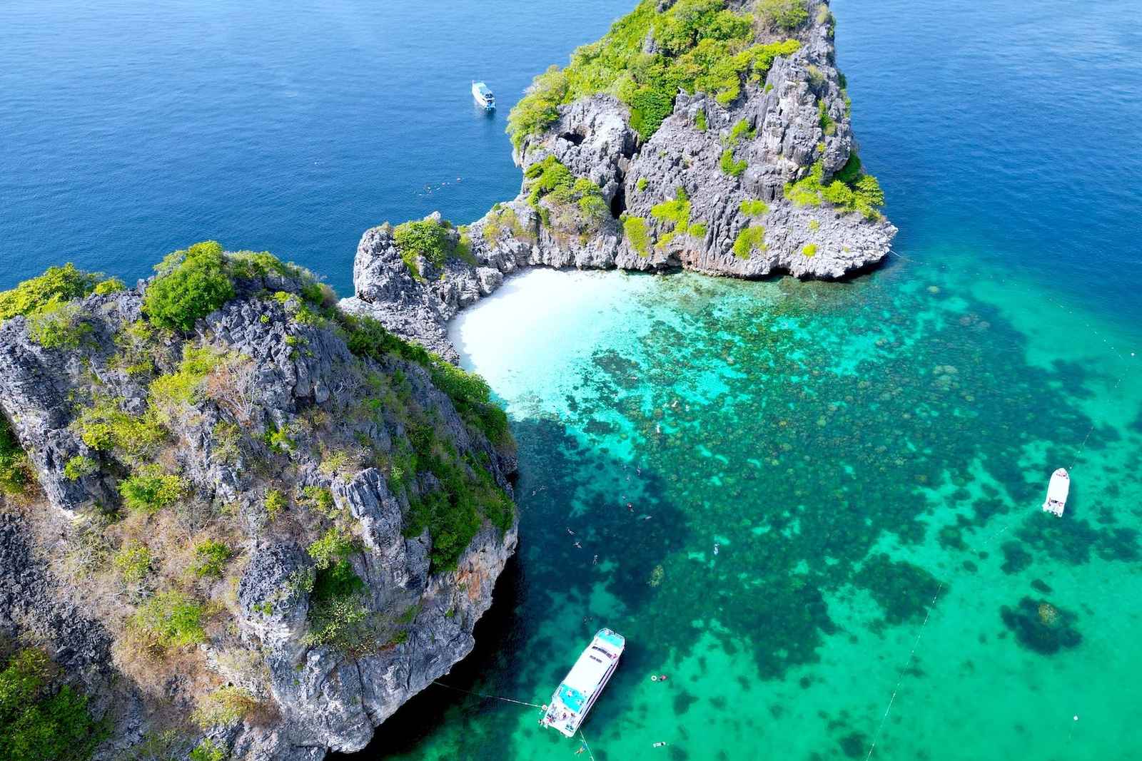 Snorkeling pickFrom US$47
Koh Rok & Koh Haa Snorkel Tour with Lunch Buffet
- 4.7★ from 650 reviews
- Snorkel at Koh Rok and Koh Haa, two of the best reef spots near Koh Lanta, lunch buffet included
Best for: Snorkelers who want the classic Koh Rok / Koh Haa day out
Check availability & price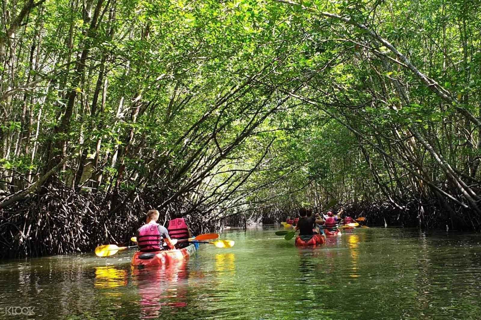 Most bookedFrom US$24
Half-Day Mangrove Kayaking Tour with Lunch
- 1,088 reviews at 4.7★: the island's most-reviewed mangrove tour
- Half-day kayak through the Thung Yee Peng mangrove tunnels, lunch included
Best for: First-timers who want one easy, well-reviewed mangrove morning
Check availability & price€5 free + 5% cashback
Join Igraal, then get cashback on every GetYourGuide booking above.
Keep planning your trip
Best Koh Lanta tours
Our ranked picks for day trips and activities
Best beaches
Compare the main beaches, north to south
Where to stay
Compare zones, prices and search hotels
Getting to Koh Lanta
Ferries, minivans and transfers explained
Still have a question? Browse all FAQs
Related guides
- Editorial standardsHow we research and date facts
- Koh Lanta travel guideFull planning overview
- Getting to Koh LantaFlights, transfers and the car ferry
- Best time to visit Koh LantaSeasons and closures explained
- Where to stay in Koh Lanta by traveller typePick a beach area for your trip
- Koh Lanta vs other Thai islandsHow it compares